What if you could see every inch of your plant without ever setting foot inside it?
For decision-makers managing sprawling assets in Oil & Gas, Utilities, Ports, or Manufacturing, blind spots in operations aren’t just inconvenient; they’re expensive. Downtime, safety risks, and inefficient maintenance stack up quickly. That’s where drone-based 3D capture for digital twins changes the game.
This technology isn’t science fiction. In fact, it’s being used right now to help enterprises monitor, simulate, and optimize operations like never before.
In this post, we’ll break down how drone-enabled 3D scanning feeds into high-fidelity digital twins, and why it’s a smart investment for industrial enterprises that want data-driven decisions, faster.
What is Drone-Based 3D Capture?
Drone-based 3D capture uses aerial drones equipped with LiDAR, photogrammetry, or multispectral sensors to collect precise data on physical environments. This data is then processed into a 3D model or point cloud, often forming the foundation of a digital twin.
Unlike traditional methods, drone capture is:
- Faster: It covers large facilities in hours, not days.
- Safer: It eliminates the need for scaffolding or human entry in hazardous zones.
- More Accurate: LiDAR enables millimeter-level precision.
- Cost-Efficient: It reduces manpower needs and downtime.
How Drone-Captured 3D Data Powers Digital Twins
A digital twin is a real-time, virtual representation of a physical asset or system. However, for it to be effective, the data powering it must be:
- Accurate
- Up-to-date
- Spatially rich
How drone-based data supports each of those pillars:
| Step | Drone’s Role | Impact on Digital Twin |
|---|---|---|
| Capture | Scans buildings, equipment, pipelines | Creates base 3D models with real-world dimensions |
| Sync | Feeds real-time sensor and image data | Keeps the twin continuously updated |
| Simulate | Inputs predictive simulations | Tests scenarios like leaks, failures, and downtime risks |
| Optimize | Delivers visual + data-driven insights | Drives decisions in maintenance, safety, and efficiency |
Use Case: Port Logistics Optimization
A leading port operator in the GCC used drone-based scanning to model over 120 acres of container terminals. Once the digital twin was created, the benefits became immediately clear:
- Bottlenecks in vehicle flow were simulated and resolved.
- Fuel usage dropped by 18% due to optimized vehicle paths.
- Maintenance planning improved, which reduced unexpected breakdowns by 26%.
Because drone data fed into a live dashboard, operations teams could act in real time, something CAD maps or static models could never deliver.
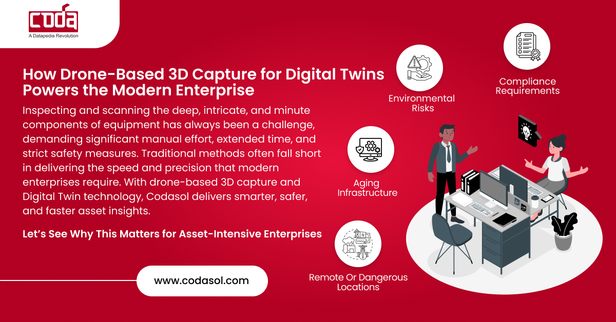
Why This Matters for Asset-Intensive Enterprises
If you’re in charge of facilities or operations in sectors like Oil & Gas, EPC, or Utilities, you’re probably juggling:
- Compliance requirements
- Environmental risks
- Aging infrastructure
- Remote or dangerous locations
Drone-based 3D capture offers a scalable solution that works across assets, whether offshore rigs, chemical plants, or metro tunnels. It’s not just about imagery. Rather, it’s about transforming that imagery into intelligence.
When paired with real-time sensors and AI, your digital twin becomes more than a mirror; it becomes a prediction engine.
How to Get Started
You don’t need to overhaul your systems to start using drone-enabled twins. Instead, follow a simple phased approach:
- Start with a single facility scan: Create a high-fidelity base model.
- Integrate live sensors: Feed real-time data into the model.
- Run simulations: Test stress points, breakdowns, or energy savings.
- Expand enterprise-wide: Scale across plants, ports, or geographies.
This phased approach not only reduces upfront investment but also delivers quick wins.

Want to see what your plant could look like in a high-precision 3D digital twin? Discover how drone capture accelerates your path to data-driven operations.
Integrating with Your Existing ERP and MDM Systems
Many enterprises worry about integrating new tools. However, platforms like CODA are designed to plug into your existing data infrastructure.
With connectors for SAP, Oracle, and Maximo, your digital twin doesn’t sit in a silo. Instead, it becomes the command center, bridging engineering, operations, and data science.
Security and Compliance Built-In
In regulated industries, it’s not just what data you capture—but how you handle it. Thankfully, drone-based data platforms today support:
- End-to-end encryption
- Geo-fencing and no-fly compliance
- Cloud or on-prem hosting for sensitive industries like defense or banking
As a result, digital transformation doesn’t have to mean digital risk.
Don’t wait for the next outage or audit.
Learn how digital twins powered by drone capture can future-proof your infrastructure.

Frequently Asked Questions
1: How accurate is drone-based 3D scanning?
With LiDAR-equipped drones, accuracy can reach up to 2–3 cm, depending on flight conditions and terrain.
2: What types of industries can use drone-enabled digital twins?
Any industry with physical infrastructure: Oil & Gas, Ports, Utilities, Manufacturing, Real Estate, EPC, Defense, and more.
3: Is this technology expensive to implement?
Not anymore. Thanks to SaaS platforms and scalable capture options, you can start small and scale up affordably.
4: Does this replace human inspection teams?
No, but it enhances them. Think of drone-based twins as a force multiplier, allowing teams to work faster, safer, and smarter.
5: Can this integrate with existing ERP systems?
Yes. Platforms like CODA offer plug-and-play compatibility with SAP, Oracle, Maximo, and more.
By combining drone-based 3D capture with digital twin technology, enterprises no longer have to guess what’s happening. Instead, they can see it, simulate it, and solve it before it becomes a problem.